

Lively, lost 1808, Whaler.
Rowley Shoals
S 17° 05.379' E 115° 29.968'
The life of the Lively
The Lively was first laid down in a Saint Malo shipyard on the Brittany coast in France in 1765. She was originally named Duchesse d'Aiguillon and sailed as a fishing vessel off the east coast of North America. After the French Revolution of 1789 the 240 ton sailing ship was renamed the Abeille and continued to sail as a fishing vessel until the French Republic requisitioned the vessel as a transport. In 1795, the Abeille was captured and taken as a prize by the British Royal Navy with five other merchant ships while sailing off the Brittany Coast.
The Abeille was condemned one year later and sold into private enterprise where it changed owners twice. By 1798 the Abeille was renamed the Lively and underwent an extensive refit by it's second owner Daniel Bennett and the Lively went to sea as a whaler, fishing the South Atlantic completing seven successful voyages.
In early 1808 after over 40 years of service the Lively was wrecked on the western side of the then unnamed reef off the north coast of Australia. The Rowley Shoals had only been sighted by Europeans eight years previously, first by Captain Josias Rowley onboard the HMS Imperieuse who sighted Imperieuse Reef, the southernmost atoll, then by a Captain Clerke, a whaler who sighted Clerke Atoll, both of which remained unnamed until Phillip Parker King charted and named the Atolls in 1818 in their honour. Mermaid Atoll was named after Captain Parker King's vessel the Mermaid.
The Lively was likely returning from whaling grounds in the Timor Sea and was travelling in company with another Whaler, the Ranger, which managed to rescue the full compliment of the Lively’s crew. There is very little account of the wrecking event.




Diving the site:
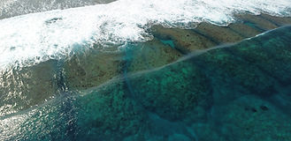
The iron remains of the Lively lay in a reef drain on the western edge of Mermaid Atoll, the northern most atoll of the Rowley Shoals group. The small site sits within metres of the drying reef shelf and experiences the full force of the westerly swell breaking over the site. With a tide variation of 4 metres, the site is best dived when the swell is low and at high tide. A preference would be for the last of the incoming tide before the current starts flowing off the reef and into the oncoming swell causing it to stand and break over the site.
Caution should be taken when approaching the site by boat. Anchoring on the reef shelf is prohibited and never advisable and the deep slope of the atoll offers no decent anchorage where sand is available. It is recommended to live boat the divers near the site and swim in. The swell observed in the area is unpredictable and even on a low swell day, the occasional set would come and break 20 metres west of the site.
Caution should be taken by divers not to get carried onto the reef east of the site and sucked over the reef shelf with the breaking waves where a retrieval would be not possible by the dive boat. Like all sites, sit and watch and asses the conditions for a decent amount of time before entering the water and proceeding into the high energy dive site.
Site description:
The already excavated remains of the Lively wreck site lay in a small narrow sand gully or reef drain in around 4 metres of water surrounded by reef that would almost dry at low tide. The site is a very small site, only about 15 metres in length. Museum reports record that there is further debris scatter and anchors located on top of the drying reef shelf up to 250 metres to the east. The most obvious feature of the site is the admiralty style anchor, with one fluke buried in the sand/rubble at the bottom of the drain. The anchor is the western most feature of the site, five metres east of the anchor, on the southern reef rim of the drain, is a large noticeable cauldron or “try pot” concreted to the reef. Less distinguishable, immediately east of the try pot, the rear section of a small canon can be distinguished as part of the reef, heavily incrusted and concreted to the reef edge.


The site model:
The model was produced under very challenging conditions by a surface diver under the breaking swell on the western rim of Mermaid Reef. It was captured with a small compact digital Olympus point and shoot camera after a technical failure with our normal recording equipment. The model was captured with a small dataset of only 198 images while diving underneath the foam and white out surface conditions and pulled together with Agisoft Metashape and animated by BelowJS.com. It can be view and downloaded at the divingwawrecks, Sketchfab.com account.